The scenario: "Create a series of maps that highlight areas in Metro Vancouver that are at risk to flooding during a storm surge." -Lab 3 description
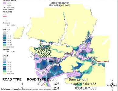

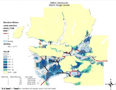
The sea level rise phenomenon due to climate change is one occurrence that the city of Vancouver will not be immune to, considering the proximity of the city and its surrounding metropolis to the ocean. The city is currently planning for shoreline mitigation efforts and overall city resiliency to future rising sea level. The purpose of this post is to exhibit the flood risk areas of Metro Vancouver, also accounting for schools and the new St. Paul's hospital risk to flood surge in case of massive rainstorms or exponentially-rising King tides.
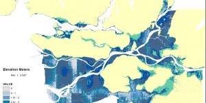
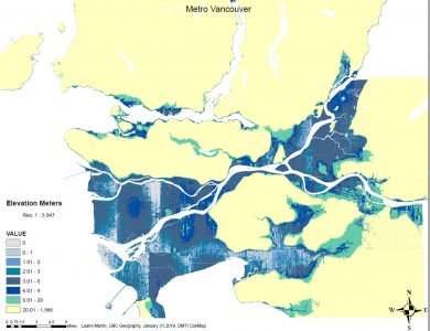
These maps I worked with presents the varying elevations of Vancouver and Metro Vancouver, focusing on the low leveled areas (at sea level). As you will also observe, the 'Flooding' map and 'False Creek' map are noticeably different due to their map scale and raster size. Such as, the 'Flooding' map encompasses the entire city, hence the generalization of the area. On the other hand, the 'False Creek' map has a higher resolution since it concentrates on a larger scale (focusing on False Creek area only). Due to the low resolution raster data, there is a large pocket for error in terms of pin pointing a specific location on the map.
-Raster resolution plays an important role in map accuracy
-Where to find open data source for mapping in Canada, specifically in the city of Vancouver
-Projecting layers "on-the-fly"