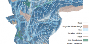
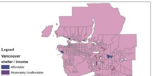
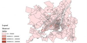
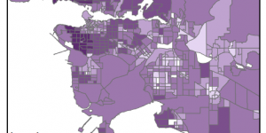
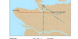
Final Project: Analysis of the Skytrain Extension to UBC and its Impact on Cost of Housing

The Skytrain extension from Commercial-Broadway station to Arbutus street has completed its phase 1 evaluation and on its way to development, but the new phase 2 evaluation is considering a further extension from Arbutus street into UBC campus. My group and I discussed the possible impacts of this phase 2 extension on housing affordability and rapid transit ridership.


Lab 4: Cost of Housing

Navigated through Canadian Census Analyser site (CHASS) and downloaded cost of housing data for Vancouver and Montreal, then moving them into the file Geodatabase.


Lab 3: Planning for Flooding/Storm Surge

The technical aspect: This lab acquainted me to analyzing the difference between raster and vector data, and when to appropriately use these datasets when creating a map from scratch, i.e. downloading data from an open data source. I further familiarized myself with properly projecting coordinate systems, and how to troubleshoot different coordinate systems among varying layers of a dataframe