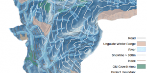
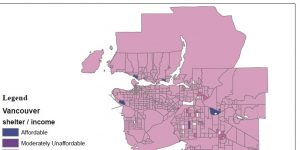
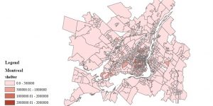
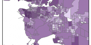
Experience with Final Project

Explored different topics and data analysis to work on for our final GIS project. Our group brainstormed research topics and coordinate data downloads to have an organized mapping system- manageable for a three-person team.


Lab 4: Cost of Housing

Navigated through Canadian Census Analyser site (CHASS) and downloaded cost of housing data for Vancouver and Montreal, then moving them into the file Geodatabase.


Lab 4: Data Uncertainty

What are the rules of Statistics Canada on data suppression in terms of Census Tract (CT) and Dissemination Area (DA)?


Lab 3: Planning for Flooding/Storm Surge

The technical aspect: This lab acquainted me to analyzing the difference between raster and vector data, and when to appropriately use these datasets when creating a map from scratch, i.e. downloading data from an open data source. I further familiarized myself with properly projecting coordinate systems, and how to troubleshoot different coordinate systems among varying layers of a dataframe