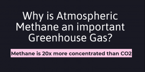
Dangerous Concentrations of Methane can Lead to Climate Change Acceleration
A higher concentration of Atmospheric Methane can accelerate Global Warming in dangerous levels.
A higher concentration of Atmospheric Methane can accelerate Global Warming in dangerous levels.
Explored different topics and data analysis to work on for our final GIS project. Our group brainstormed research topics and coordinate data downloads to have an organized mapping system- manageable for a three-person team.

My Personal Statement in line with the skills and knowledge I acquired in my introductory Geographic Information Science (GIS) course.
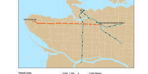
The Skytrain extension from Commercial-Broadway station to Arbutus street has completed its phase 1 evaluation and on its way to development, but the new phase 2 evaluation is considering a further extension from Arbutus street into UBC campus. My group and I discussed the possible impacts of this phase 2 extension on housing affordability and rapid transit ridership.
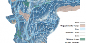
Assessing the environmental implications of the newly proposed Garibaldi Ski Resort in Squamish
Further practiced my skills on editing data classification and mapping aesthetically.
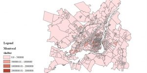
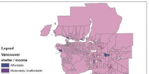
Navigated through Canadian Census Analyser site (CHASS) and downloaded cost of housing data for Vancouver and Montreal, then moving them into the file Geodatabase.

What are the rules of Statistics Canada on data suppression in terms of Census Tract (CT) and Dissemination Area (DA)?
I acquainted myself with the data classification attributes. I also learned how to create a file geodatabase in ArcCatalog.

I gained valuable soft skills during my time in Project Imagine. I coordinated, collaborated, multitasked, and until now, I am constantly learning from our executive team and volunteers.